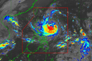
THE STATE weather bureau on Monday said Kong-rey (local name: Leon) has intensified into a severe tropical storm and could become a typhoon in the next 24 hours.
In a 5 p.m. bulletin, the Philippine Atmospheric, Geophysical and Astronomical Services Administration (PAGASA) said Kong-rey was expected to rapidly intensify into a typhoon as its passes over the Philippine Sea.
“There is an increasing chance that Leon will reach super typhoon category during its period of closest approach to Batanes,” PAGASA said.
The intensification of the storm prompted the agency to raise tropical wind signal No. 1 over areas in Luzon and the Visayas.
PAGASA has placed Ilocos Norte, Ilocos Sur, La Union, Pangasinan, Apayao, Kalinga, Abra, Mountain Province, Ifugao, Benguet, Cagayan including Babuyan Islands, Isabela, Quirino, Nueva Vizcaya, Nueva Ecija, Tarlac, Zambales, Bataan, Pampanga, Bulacan, Metro Manila, the northern portion of Rizal, and the northern portion of Cavite under signal No. 1.
Signal No. 1 was also hoisted over the eastern portion of Northern Samar and northern portion of Eastern Samar.
The storm was last seen 725 kilometers east of Echague, Isabela province, and was moving west northwestward at 15 kilometers per hour (kph).
The storm was packing maximum sustained winds of 100 kph and a gustiness of up to 125 kph.
Kong-rey is the second storm to hit the Philippines this October, after Severe Tropical Storm Trami, locally named Kristine, last week.
Kristine had caused intense rainfall and flooding over several provinces, prompting 158 areas to declare a state of calamity.
About 100 people have died and more than half-a-million were forced to flee, according to the National Disaster Risk Reduction and Management Council. — Adrian H. Halili

